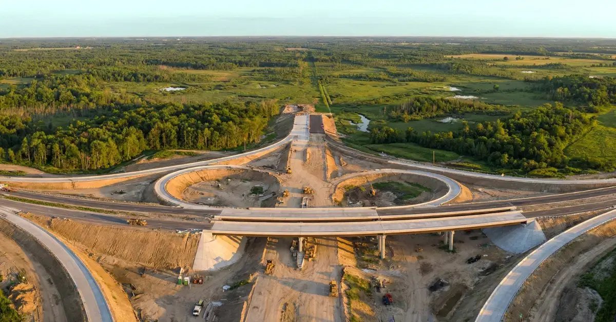
Land Development Infrastructure for West Texas Sites
Raw land becomes a building site through a sequence of infrastructure steps, and on West Texas tracts those steps are spread over long distances: streets that run for a mile before the first lot, utilities that connect to a main on the far side of a highway, and drainage that crosses several owners. We coordinate the sequence from stakes to street, and we pour the concrete that gives a development its curbs, sidewalks, inlets and approaches.
Trade partners under our coordination handle earthwork, utilities and paving, and the concrete partners we coordinate step in wherever concrete takes over. That arrangement makes us a natural fit for developers who want one party tracking the order of work, the inspection holds and the points where one trade hands off to the next.
What follows describes how we schedule development work, which services connect to it, who buys it, where we work, what the sites demand and how we keep people safe.
The order of work on a development
The order matters because each step makes the next one possible. Clearing and erosion control come first, then mass grading, then utilities in the street, then subgrade, base, curb and paving, and finally sidewalks, driveways and final grade. Jumping ahead causes rework: a street cut for a late water tap is a street that settles.
We build a schedule with inspection holds, lab visits and utility tests as fixed points. For remote tracts, we add travel and weather time to each phase, and we avoid splitting a phase across many short visits when a single longer mobilization will do.
Weather windows decide when the paving and flatwork phases can run. Concrete streets and sidewalks do best in the mild months, so we try to complete underground work during summer and winter and schedule the pours for spring and fall. When a developer needs lots delivered by a fixed date, we work backward from that date and protect the paving window first.
Services that make up the development scope
The scope usually includes mass grading, storm drain installation, water main installation and curb and gutter. It ends with sidewalks and driveways, and sometimes a detention pond.
Each piece has its own crew and its own testing, and the schedule holds them together. We watch where scopes meet, such as the point where a storm inlet joins the curb line.
Many developments also need a detention pond, which ties to pond and basin excavation, and an entrance with a deceleration lane that follows road subgrade preparation standards. We list these items in the first schedule so that none of them appears late in the project.
Developers, cities and campuses
Commercial developers, homebuilders and industrial park owners all need streets and utilities before they can sell lots. Western Texas College in Snyder is a two-year community college with programs in petroleum technology, solar energy technology and welding, and campus-related development around Snyder shows how education and industry draw new infrastructure.
Municipal and county buyers often fund infrastructure for economic development. See homebuilders and multifamily developers and municipal and public works for how each handles bidding and inspection.
Industrial park owners care about truck access, rail spurs and heavy-duty paving, while homebuilders care about lot grades, driveways and street appearance. Retail developers focus on pads and parking. We adapt the concrete details to each, such as thicker sections and doweled joints for truck routes, and standard sections for residential streets.
Development sites along farm roads and highways
U.S. Highway 84, Farm to Market Road 400 and Farm to Market Road 41 serve Slaton, so a tract near Slaton can draw materials from the Lubbock side. Farm Road 1750 serves Potosi, which lies roughly nine miles southeast of Abilene in the eastern part of Taylor County, so a tract there is a short drive from an Abilene staging point.
At the center of Santa Anna, the routes of U.S. 84, U.S. 67 and U.S. 283 come together. A site near Santa Anna benefits from that access but also faces highway permit requirements, which we handle early.
A development in this region can mean a long trip for every trade. We choose a staging point near the tract, often a town with a motel and a supply house, and we plan weekly rather than daily deliveries for materials that do not spoil. Crews stay close to the work and return home on a set rotation.
Land, water and utilities
Ozona has a hot semi-arid climate with about 19.84 inches of precipitation a year and an elevation of 2,349 feet. Dry land makes grading easier but also makes dust and wind erosion significant, and when rain does come it tends to fall hard, so drainage must be sized for intense storms.
Utility availability decides much of the cost. A site far from a water main needs a long extension, and a site without sewer may need a lift station or septic design. We ask for the utility letters early and flag any shortfalls before the owner commits to a layout.
Neighbors and landowners also affect the plan. Easements, adjacent ranch gates and shared roads need to be respected, and cattle guards or temporary crossings may be needed. We walk the tract boundary with the owner and note every constraint that could turn into a delay.
A busy site with many trades
A development site has pipe crews, graders, haul trucks, surveyors and concrete crews working in the same area. We use daily coordination, marked haul routes and clear zones for each trade. Open trenches and excavations are barricaded, and a competent person checks them.
Heat, wind and dust are constant companions on these sites. Water stations, shade and early starts help the crews, and dust control protects nearby homes and roads. Public access to the site is limited with fencing and signs.
New streets under construction attract curiosity, so signs and barricades at open entrances are not optional. At the end of each day, we make the site safe by closing trenches, backfilling or plating them, and removing loose items that wind could carry.
Discuss your tract with us
Send the plat, the utility letters and the target schedule, and name the nearest town to the tract. We will outline the phases, mark the inspection holds and phone to talk through travel and sequencing before trade partners are lined up.
Common Questions
How do you phase a large development?
We break the site into phases that can be built, inspected and accepted independently. Each phase has its own grading, utilities, paving and concrete, and the developer can sell lots as phases finish. Phasing also limits the open ground and the stormwater risk at any one time.
What approvals do we need before starting?
Usually a plat approval, a grading permit, utility approvals and a stormwater permit. Highway access may add a state permit. We help the owner list the approvals and the lead time for each, so that construction does not start before everything is in place.
Can you work with the city engineer on inspections?
Yes. We schedule inspections in advance, provide the test reports and keep the inspection log current. Small-town engineers often handle many projects, so early notice helps. We also confirm hold points in the plans so that nothing is covered before it is approved.
How does distance affect the price?
Distance affects crew travel, material delivery and the time that equipment is idle between phases. We compare the cost of keeping crews on site with the cost of returning, and we choose the option that is cheaper overall. The owner sees the breakdown in the proposal.