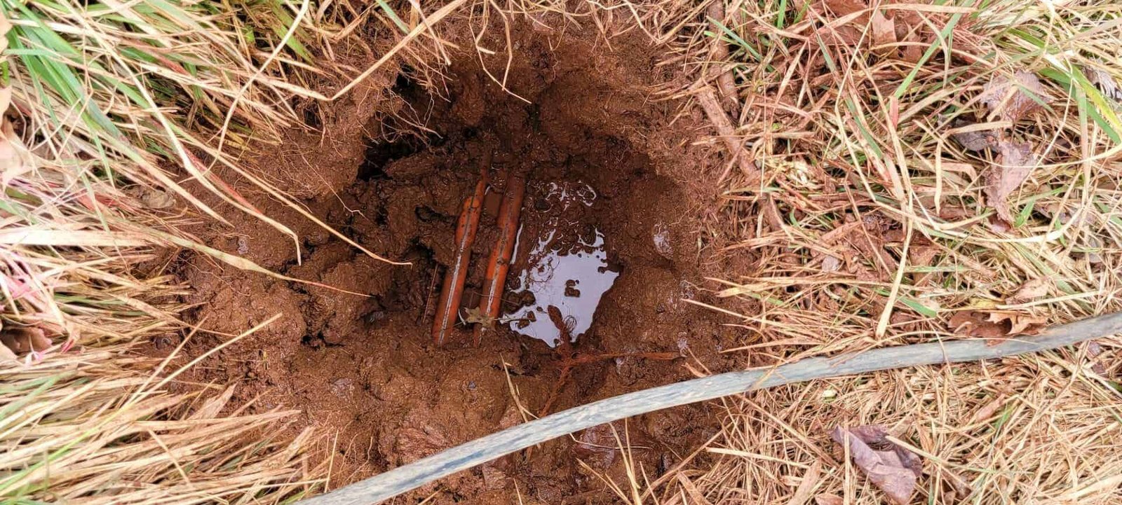
Utility Potholing and Locating in West Texas
Records of buried lines in a small West Texas town are often a mix of one old sheet in a city hall drawer, a utility's map that stops at the property line and the memory of a retired crew member. Potholing replaces that uncertainty with a hole. We expose underground lines with vacuum excavation or hand digging at the points that matter, measure their depth and position, and record the result before trenching, boring or foundation work begins. Locating covers the broader task of tracing and marking lines with the help of utility locate services and private locators.
A strike costs far more than the potholing that would have prevented it. A hit on a gas line, a fiber bundle or a pressurized water main can stop a job, endanger the crew and interrupt service to customers who had nothing to do with the project. Compared with that, a morning of vacuum digging at a crossing is a small line in the budget.
The concrete partners we coordinate work alongside trade partners who run the vacuum trucks and locating equipment, and we place the permanent concrete or flowable fill that restores each hole. The deliverable is a clean record of what is where, tied to survey points the engineer can place on the drawings.
Where potholing earns its keep
On a new school or addition, old campus lines of every kind cross the new footprint, and the district rarely has full records. At a hospital, medical gas, power, water and data lines run in tight bundles, and an error shuts down patient care. Industrial plants carry layers of added pipe and conduit built over many years, and retail lots sit over service lines that were moved more than once.
The common thread is that the cost of a strike rises with the importance of the building. A short potholing program at the early design stage reduces change orders and lets the engineer route new lines around real obstacles.
Locates, one-call rules and records
Before digging, state law requires a notice to the one-call center for underground facilities, after which each member utility marks its lines within a set period. Those marks cover public utilities, not private lines on an industrial or farm property, and the marks are approximate. Potholing confirms depth and offsets, which are the numbers the engineer actually needs.
The specification may call for a particular standard of quality for subsurface utility information, and some owners require stamped reports. We follow the owner's format, tag each pothole with a number and survey point and keep photos with a tape in the frame. The records are available for permit submittals and for the closeout file.
Steps from mark to backfill
The work begins with a review of records and a one-call ticket. We mark proposed pothole locations, usually at crossings, tie-ins and points where a new line gets close to an existing one. A vacuum excavation partner opens each hole, pulling soil into a tank without scraping the line. Hand tools finish the exposure near live lines.
We measure top and bottom elevations, pipe size and material, direction and the offset from a fixed point. Each hole is photographed and logged. Backfill follows with compacted material, flowable fill or concrete, and the surface is restored to match its surroundings. Results go into a table the design team can use.
Who does what at the pothole
Vacuum trucks and locating gear belong to specialist partners, and we coordinate them. The concrete partners handle layout, hand digging near sensitive lines, and the concrete or paving repair that closes each hole. Because the same company handles both the information and the restoration, a pothole does not turn into a depression in a parking lot six months later.
The split also helps the schedule, since our foreman can start trenching as soon as the information is delivered rather than waiting for a separate survey package to circulate.
Getting the information early
Potholing is best done before design is final, so the engineer can adjust grades and alignments. When that is not possible, we schedule it just ahead of the trench crew, a day or two earlier, so the data is fresh and nobody covers a hole by mistake. Vacuum trucks are in demand, and the closest one may be several hours away, so we book early.
Weather matters. Frozen ground slows digging, and heavy rain makes the soil hard to vacuum. In windy conditions, loose spoil can blow around the site, so we protect adjacent surfaces.
Owners who ask for potholing
Oil, gas and midstream owners need to know where pipelines and flow lines run before any heavy equipment moves. The Santa Rita No. 1 well struck oil near Big Lake in 1923, and the Big Lake field grew into the first major oil field in the Permian Basin by 1924, so the ground near old fields is crowded with lines of many ages.
Municipal and public works departments request potholing ahead of street and utility projects, and utility owners ask for it before relocations. Farmers and ranchers who add a building often find out that a pipeline crosses the planned pad.
Digging near live lines
Safety rules for excavation near utilities are strict, and we follow them: no mechanical digging within the tolerance zone of a marked line, spotters at every hole, barricades around open pits and hand tools near gas and electric lines. Crews wear the required protective gear, and the plan covers what to do when a line is hit or damaged.
Dust control matters in open country. In the northern part of Ward County, shifting dunes erode in the wind, and loose sand there can fill a pothole in a gust. We cover or backfill holes the same day and fence any that must stay open.
Potholing as a first step
Potholing leads into other work. It feeds the design for site utilities, protects crews doing utility relocation, and makes trenching and backfill safer and faster. Around Andrews, where U.S. 385 meets two state highways, crossings of roads and pipelines are the most valuable places to look, and Andrews projects often begin with a set of holes along the route.
With the information in hand, the rest of the schedule firms up and the owner can talk to the team about real quantities.
Mark the crossing points
Send the route, the utilities you suspect and any records you have. We can help choose pothole locations and arrange a crew and a vacuum truck to open them before trenching begins.
Common Questions
Is a utility locate the same as potholing?
No. A locate marks the approximate path of a line using surface signals, and the accuracy varies. Potholing exposes the line itself and measures it. Many projects use both.
How many holes should we plan for?
The count follows the number of crossings and how far the records can be trusted. We usually recommend holes at every crossing of a major line and at tie-in points. The engineer and our team can decide the list after reviewing the plans.
Does vacuum excavation damage pipe?
It is a gentle method that uses air or water to loosen soil, then a vacuum to remove it. It is much less likely to harm a line than a backhoe. We still finish the last few inches by hand near sensitive lines.
How is each hole closed?
We backfill and compact it, or pour flowable fill or concrete where pavement sits above. We restore the surface to match what was there. The location stays on the record drawing.